


The heatwave continues for another week. There have been some changes over the weekend with a noticeable breeze taking the edge off the intense heat in parts of Britain. Last week, Wisley in Surrey saw 35.5C, the highest temperature for this July, and temperatures have now passed 35C in May, June and July this year with three heatwave events.
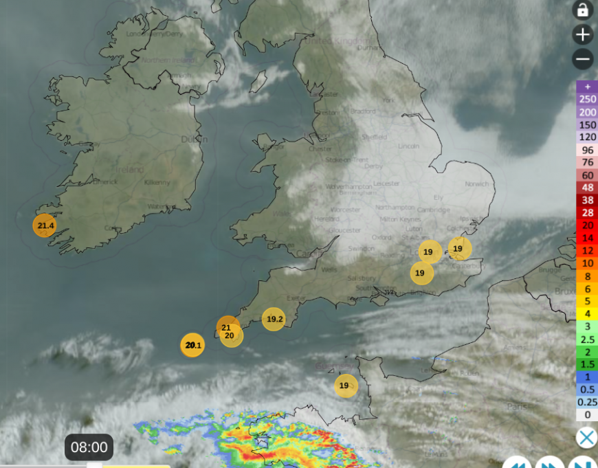
It is now the 10th day of heatwave conditions for a few areas around London. The fresher breeze off the North Sea at the weekend reset the counter for much of eastern Britain. Parts of coastal northeast Britain sat under low cloud with persistent drizzle and temperatures of 13 to 16C on Saturday as southwestern Britain baked under brilliant sunshine. Hurn near Bournemouth airport, Dorset grabbed the top temperatures on both days at the weekend: Saturday 33.2C and 32.6C on Sunday. This week, the top temperatures look to be around 30 to 32C but that is still above the heatwave thresholds of 25 to 28C.
The heatwave threshold temperatures are reviewed every decade. This last happened in 2022 as our climate continues to warm. Impacts on health, water supplies, infrastructure and nature occur and there is a higher likelihood of wildfire spread.
“In March 2022, the Met Office announced that the official heatwave thresholds were being updated ahead of the summer, resulting in eight counties having their threshold increased by 1 °C” Royal Met. Society
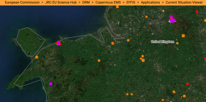
Fires in the past seven days EFFIS
Fire Incidents
“Major incident declared as 'large-scale' wildfire on Conwy Mountain forces locals to evacuate”
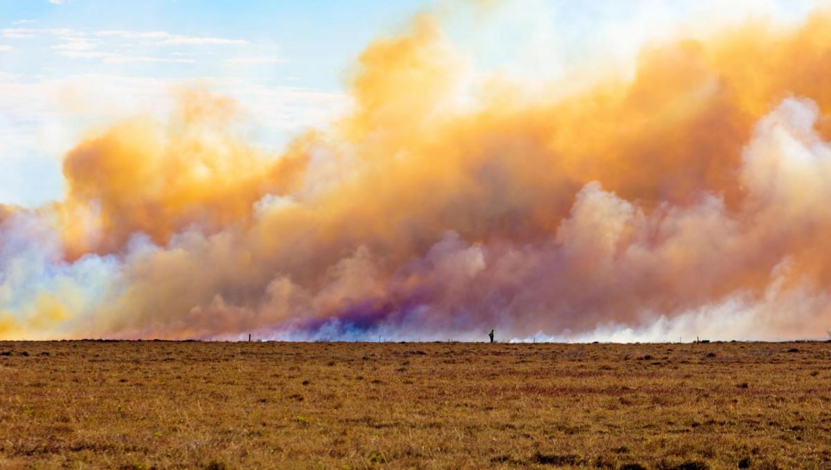
On Sunday, emergency services were tackling a "large-scale" wildfire near Sychnant Pass on Conwy Mountain. Some local residents had been advised to leave their homes as Fire & Rescue teams were fighting the blaze amid "challenging" conditions.
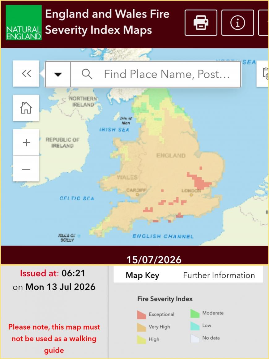
Fire severity risk forecast for England and Wales
It has been so dry and hot but over the weekend the wind picked up and there will be a brisk easterly breeze for the start of this week. So if a fire does start, the risk of it spreading quickly is very high to exceptional currently. In County Durham emergency teams were called to a fire in fields at High Shincliffe.
Pleas continue about disposal of cigarette butts, not using disposable BBQs and taking care with any naked flames in these conditions as the dry weather continues.
Monday
Overnight, there has been more low cloud from the North Sea, giving a grey, fresher start on Monday morning. This will erode and retreat back to the east coast of NE Britain. The sunshine and dry weather will continue but with a gusty wind from the east or northeast for the southern half of the UK.
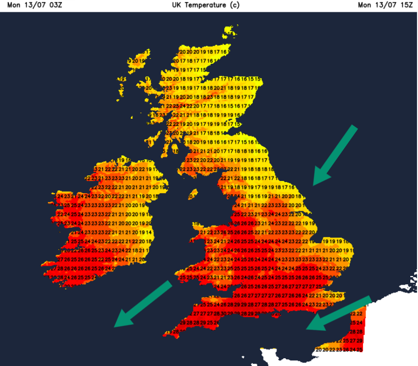
There could be a few showery outbreaks of rain clipping south Devon this evening with a bit more cloud. The Channel Islands also have a risk of showers, including thundery ones. There have been wildfires at the southern end of the island of Sark with a challenging response. A major incident was declared, the first time by Sark Fire & Rescue Service since its inception in 1958.
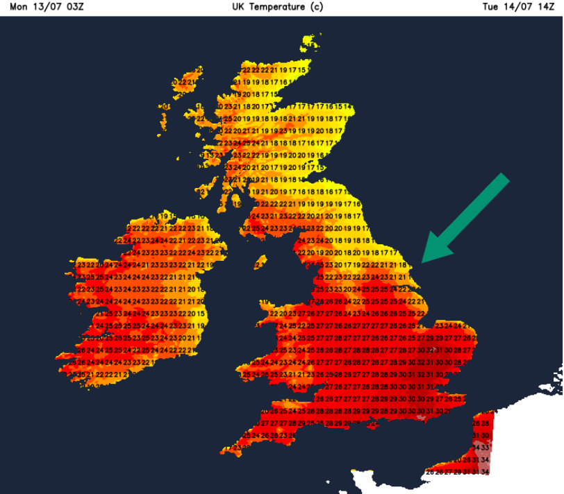
Tuesday
A similar day but the wind into eastern England will have a more northerly component to start the day and again there will be low cloud in the morning. The wind will ease for Cambridgeshire and the Home Counties on Tuesday, so temperatures will rise past 30C in the afternoon.
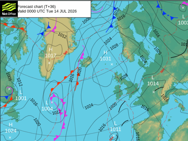
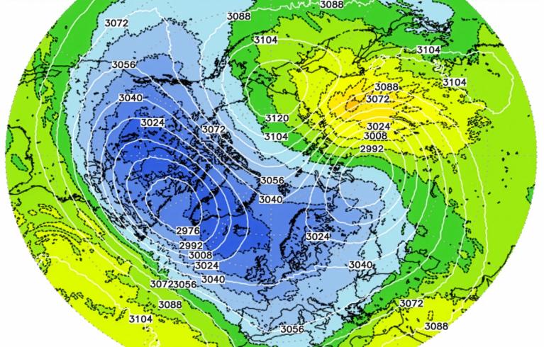
High pressure to the north of the UK will keep everything very steady this week. It directs the flow off the North Sea and keeps Atlantic weather systems at bay. There is a low pressure off the coast of NW Iberia and this tries to throw some showery bursts towards SW Britain. This might be more of a risk from midweek onwards. In the sunshine it will remain very warm to hot with surges of heat pushing up through the UK.
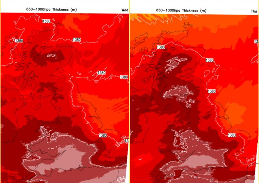
Otherwise, the east coast remains vulnerable to the fret or the haar, inland it will soon disappear and the summer heat continues for those with the sunshine. Hardly any rain in the forecast.
Loading recent activity...