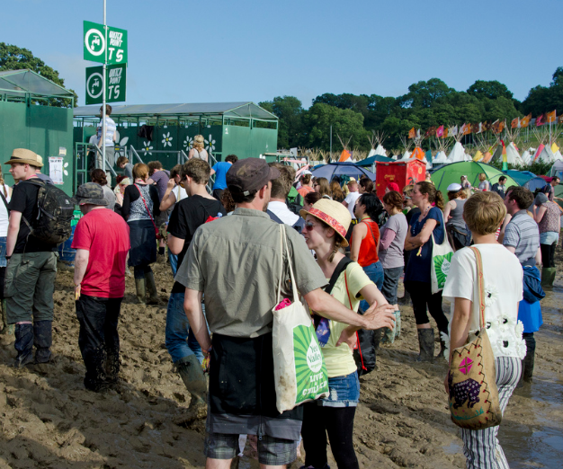
Summer UK 2022 is underway, in as much as June, July and August are considered to be meteorological summer. Wimbledon and Glastonbury are coming into view now, both vulnerable to heavy rainfall. The weather has been quite varied recently with showers and at times, had a rather cool feel to the air. However, in the strong sunshine, it feels warm with temperatures tipping into the low twenties Celsius. So far this month Bedfordshire, Wales and Highland have seen around 23C as the top UK temperatures. The air has not been very warm although at times it has felt hot in the direct sun.
May was warmer than average, by observational data if not people’s perception.
“A warm May – spurred on by high overnight temperatures – concluded a Spring that goes down as the fifth warmest on record for the UK, according to provisional statistics. The 5th warmest May on record, by mean temperature. Highest average daily minimum temperatures for May on record.” Met Office
This was due to mild nights rather than very warm days. The top temperature was 27.5C in the middle of the month when heat took hold over Spain and France, reaching London. Temperatures in late May and June can reach into the low 30sC sometimes. 32.8C is the May UK record, for June 35.6C. No signs of that heat on current forecasts.
The Netweather month ahead forecast is updated each Monday. This week’s forecast from 6th June reflects the low pressure anomaly to the east and high pressure anomaly in the North Atlantic. It keeps the changeable mixed picture with rain and showers in the period 20th-26th. For the rest of the month, the high pressure anomaly moves a little towards the UK so perhaps more settled for the start of the new month.
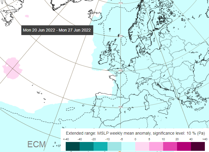
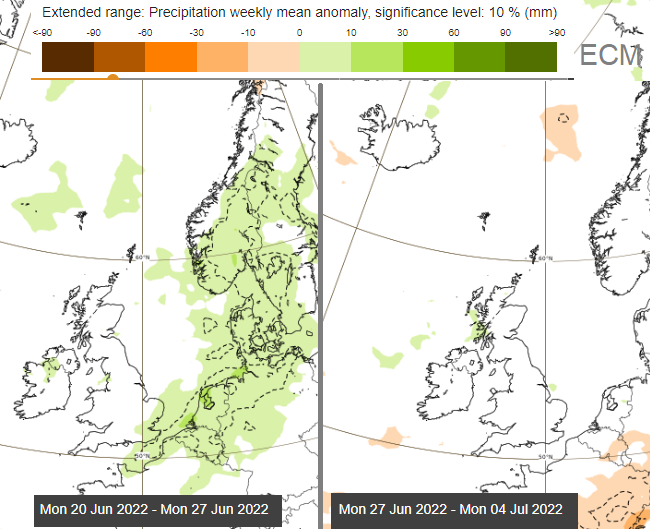
The ECM model has week long forecasts showing departures from the usual climate. The pressure chart shows high pressure out in the Atlantic, not quite over the Azores and lower pressure for much of western Europe. Again, not a strong signal. The precipitation anomalies over last two weeks show around average rainfall but hints of heavy rain for Southeast England, which could be heavy, thundery showers. Which would still have plenty of fine weather in between.
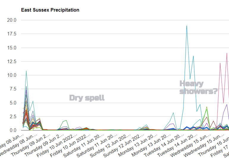
When looking a few weeks ahead, it is more about trends and likelihood. Not fine detail and specific days. There are signs of a more settled dry spell mid-month, at least for England but for the 20th June til the end of the month, there isn’t a strong signal showing. If high pressure was parked nearby that would lock the forecast down more so we might assume the last ten or so days of June look mixed and near to average in the current forecasts
The UK Met Office issues a contingency planning forecast for 3 months ahead which is used by businesses and government. It is leaning towards a warmer than average summer, the three months. So that could be a warm July and August, with a cool June. It doesn’t help much at the moment for Glastonbury packing.
Otherwise, the white areas show average conditions for late June, not a strong signal deviating from that.
The Netweather summer forecast is out, a detailed look at global drivers and thoughts for the months ahead. June - "Most rainfall towards the northwest, drier towards the southeast. The flow generally from the south or a long way to southwest. This is a warmish pattern - with temperatures likely to rise to be slightly above average overall, with potential for brief spells of hot weather in the south taking temperatures more above average - as winds back southerly for a time." Wimbledon will certainly be hoping for some of those warmer spells at SW19.
'July looks to start off with low pressure to north and northwest with the jet stream close to northern areas, high pressure close to the southeast over the near continent, this persisting for the first week. Rain mostly likely in the north and west, drier towards the southeast.' This pattern keeps on cropping up, rain and a more unsettled theme for the far NW but high pressure trying to nose in over southern England with drier weather.
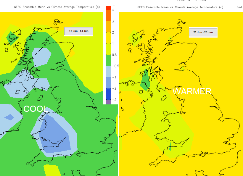
For temperatures, the GFS shows a slight warming around 21-23rd June, after a cooler dip for western parts of the UK just before mid-month.
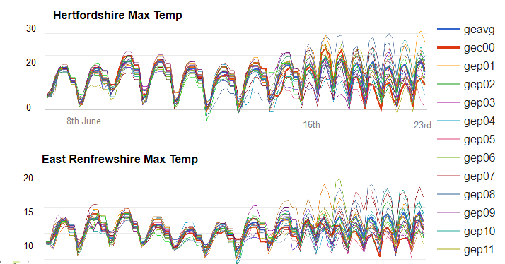
The ensemble graphs keep pretty steady over the next few weeks. For Herts, no signs of 30C and for the Central Belt, still on the cool side.
If you are looking for hot weather, there aren’t signs of heat just yet. No strong signal for high pressure over the UK which would bring steady, fine weather. Looking at the pressure chart for Thursday 23rd, there is low pressure over northern parts of the UK with a westerly flow. So not especially warm, showery in the west, drier and brighter in the west. We’ll have to wait a while to firm up on the details. Glastonbury will be 22nd- 26th June 2022. Wimbledon starts on Monday 27th June until 10th July.
Loading recent activity...